Property Record
2110 Highway 80 E, Pearl, MS 39208


NEARBY LISTINGS FOR SALE OR LEASE
Property Detail
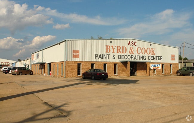
2110 Highway 80 E
E08M-000022-00000
Ne4nw4s18t5nr2e
Storebuilding
LOT 169.5 X 1049.84 X 171.1 X 1082.3 IN NE4 NW4 N OF HWY 80 LESS 1.6A N SIDE DB 533 PG 0424 0061287 DB 590 PG 0300 0120689 DB
AE
Rankin
28121C0169G
Mississippi
2024
2.54 AC
2024
Brandon/Flowood/Pearl
020304
Jackson
8,030 SF
Jackson, MS
DEMOGRAPHICS near 2110 Highway 80 E
1 Mile
3 Mile
5 Mile
2024 Total Population
3,908
19,883
62,324
2029 Population
4,019
20,329
62,238
Pop Growth 2024-2029
+ 2.84%
+ 2.24%
(0.14%)
Average Age
37
38
38
2024 Total Households
1,622
8,217
24,543
HH Growth 2024-2029
+ 2.90%
+ 1.94%
(0.31%)
Median Household Inc
$36,772
$44,129
$39,748
Avg Household Size
2.30
2.30
2.20
2024 Avg HH Vehicles
2.00
2.00
2.00
Median Home Value
$122,899
$132,251
$138,282
Median Year Built
1971
1974
1972
Nearby Places
Map Layers
Map Styles
 Street
 Aerial
- Restaurants
- Banks
- Shops
- Fitness
- Groceries
PUBLIC TRANSPORTATION
COMMUTER RAIL
Jackson (City of New Orleans - Amtrak)
DRIVE
WALK
Distance
Jackson (City of New Orleans - Amtrak)
8 min
4.8 mi
AIRPORT
Jackson-Medgar Wiley Evers International
DRIVE
WALK
Distance
Jackson-Medgar Wiley Evers International
13 min
6.0 mi
Freight Ports
Port of Greater Baton Rouge
DRIVE
WALK
Distance
Port of Greater Baton Rouge
199 min
178.0 mi
Nearby Properties
Address
Land Use
TOTAL SIZE
Lot Size
Zoning
Address
Land Use
TOTAL SIZE
Lot Size
Zoning
9,650 SF
0.55 AC
Address
Land Use
TOTAL SIZE
Lot Size
Zoning
7.60 AC
Address
Land Use
TOTAL SIZE
Lot Size
Zoning
40,148 SF
37.47 AC
Address
Land Use
TOTAL SIZE
Lot Size
Zoning
96,444 SF
0.88 AC
Address
Land Use
TOTAL SIZE
Lot Size
Zoning
115,200 SF
0.35 AC
Address
Land Use
TOTAL SIZE
Lot Size
Zoning
58.94 AC
Address
Land Use
TOTAL SIZE
Lot Size
Zoning
123,308 SF
20.88 AC
Address
Land Use
TOTAL SIZE
Lot Size
Zoning
30,925 SF
38.73 AC
Address
Land Use
TOTAL SIZE
Lot Size
Zoning
2,190,610 SF
2 AC
Address
Land Use
TOTAL SIZE
Lot Size
Zoning
9,081 SF
0.73 AC
Address
Land Use
TOTAL SIZE
Lot Size
Zoning
4,008 SF
8.30 AC
Address
Land Use
TOTAL SIZE
Lot Size
Zoning
42,520 SF
0.22 AC
Address
Land Use
TOTAL SIZE
Lot Size
Zoning
38,189 SF
1.09 AC
Address
Land Use
TOTAL SIZE
Lot Size
Zoning
Address
Land Use
TOTAL SIZE
Lot Size
Zoning
2,348 SF
16.45 AC
Address
Land Use
TOTAL SIZE
Lot Size
Zoning
1,257 SF
2.65 AC
Address
Land Use
TOTAL SIZE
Lot Size
Zoning
Address
Land Use
TOTAL SIZE
Lot Size
Zoning
Address
Land Use
TOTAL SIZE
Lot Size
Zoning
31,285 SF
2 AC
Address
Land Use
TOTAL SIZE
Lot Size
Zoning
35,232 SF
1.70 AC
Address
Land Use
TOTAL SIZE
Lot Size
Zoning
31,427 SF
40.65 AC
Address
Land Use
TOTAL SIZE
Lot Size
Zoning
28,216 SF
6 AC
Address
Land Use
TOTAL SIZE
Lot Size
Zoning
139,417 SF
13.50 AC
Address
Land Use
TOTAL SIZE
Lot Size
Zoning
9,632 SF
32.54 AC
Address
Land Use
TOTAL SIZE
Lot Size
Zoning
10,086 SF
2.41 AC
Address
Land Use
TOTAL SIZE
Lot Size
Zoning
253,479 SF
17.08 AC
Address
Land Use
TOTAL SIZE
Lot Size
Zoning
67,442 SF
2.85 AC
Address
Land Use
TOTAL SIZE
Lot Size
Zoning
1.82 AC
Address
Land Use
TOTAL SIZE
Lot Size
Zoning
80,000 SF
2 AC
Address
Land Use
TOTAL SIZE
Lot Size
Zoning
70,433 SF
2.53 AC
The World's #1 Commercial Real Estate Marketplace
Connect with us
© 2026 CoStar Group
The information above has been obtained from sources believed reliable. While we do not doubt its accuracy we have not verified it and make no guarantee, warranty or representation about it. It is your responsibility to independently confirm its accuracy and completeness. Any projections, opinions, assumptions, or estimates used are for example only and do not represent the current or future performance of the property. The value of this transaction to you depends on tax and other factors which should be evaluated by your tax, financial, and legal advisors. You and your advisors should conduct a careful, independent investigation of the property to determine to your satisfaction the suitability of the property for your needs.